
3D model of industrial zones in Daugavpils created
02 July 2019
The Daugavpils City Council as project LLI- 386 “Trans-form” partner has developed the 3D photogrammetric Reality Model of four industrial zones (~389 ha) of Daugavpils City. Now for the planning specialists and potential investors is available modern spatial planning solution aimed at revitalization of pilot areas.
☑️ 40 drone flights done, 20 875 aerophotos made, 45 support points installed and surveyed by GPS;
☑️ 3D models created for the: Northern Industrial Zone, Cherepova Industrial Zone, Daugavpils Fortress Warehouse Zone, Križi Industrial Zone;
☑️ 3D models of buildings and civil infrastructure integrated;
☑️ Interactive 3D City application for internet and touch-screen monitors created.
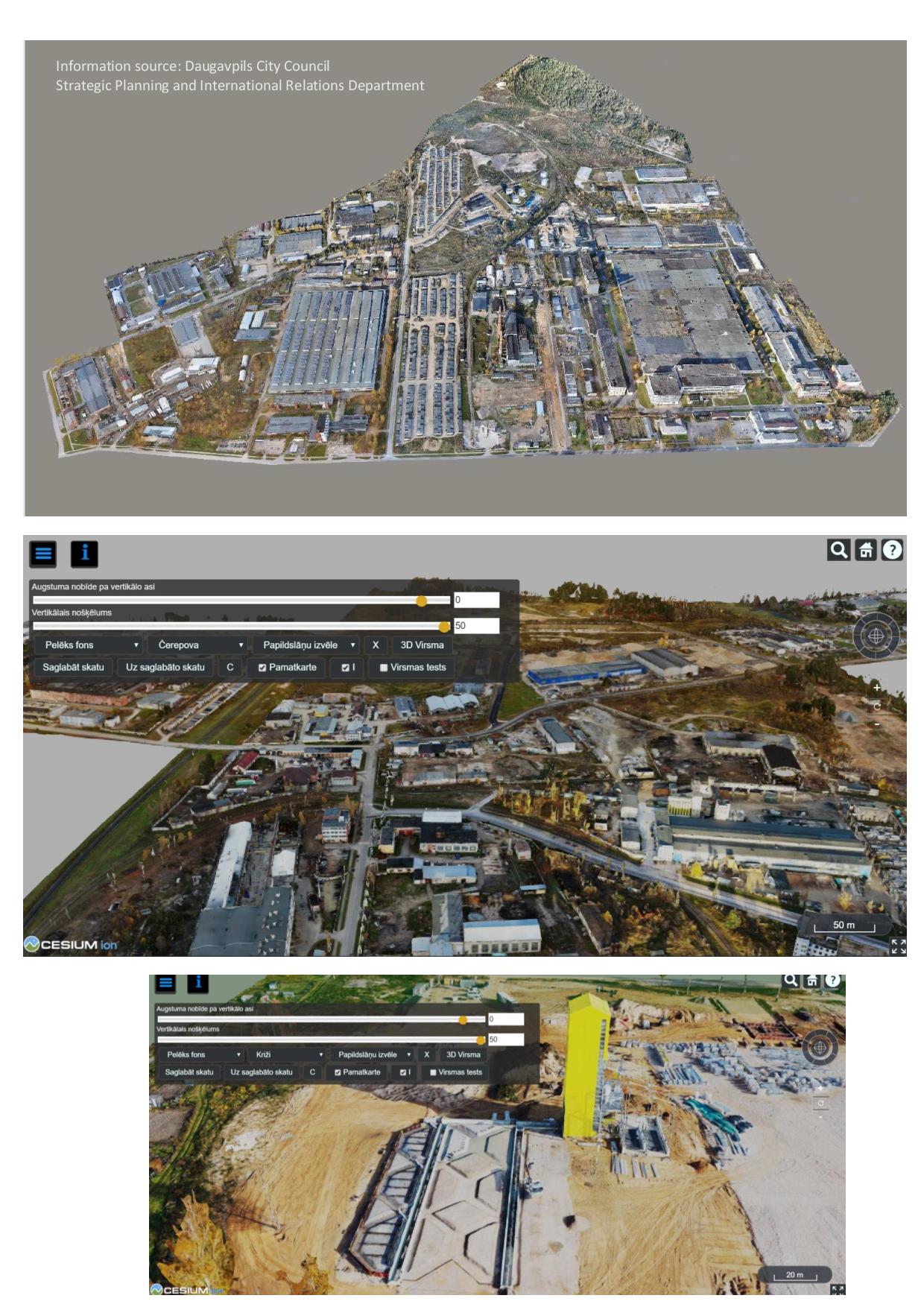
Link to the 3D model tool: http://3dpilseta.daugavpils.lv/industr_zones/
Līga Upeniece,
Project Information Manager
Latvian office of Euroregion “Country of Lakes”
Last updated: 26.06.2024 15:10